
AUSTIN (KXAN) — Stunning images from above the Earth show the effect of power outages across Texas this week, which at one point left more than 4 million people without power.
In the wake of multiple rounds of winter storms, demand for energy increased in Texas. The company that manages the power grid, the Electric Reliability Council of Texas, was forced to shed some of the load, which caused blackouts after ERCOT had ordered utility companies to cut power usage, NewsNation affiliate KXAN reported.
Some areas were supposed to begin rolling those blackouts among customers, but instead the need was so high that local utility companies couldn’t complete that process while still keeping essential customers like hospitals online.
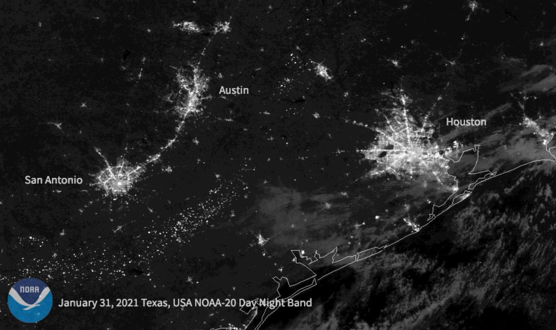
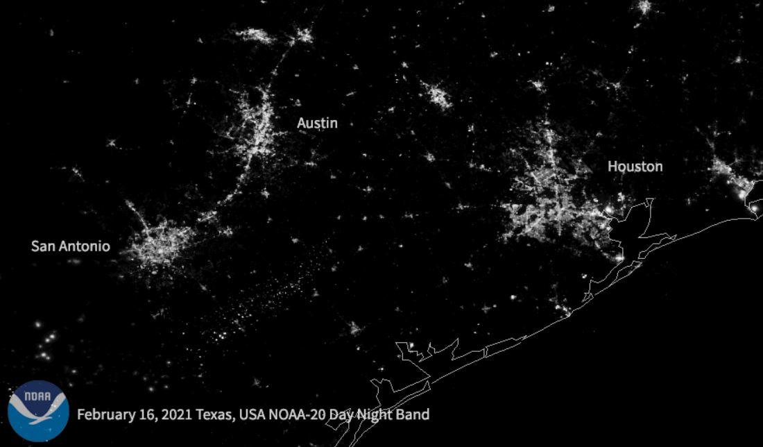
The NOAA-20 satellite’s images show bright city lights across Texas before the storm on Jan. 31, 2021 and the significantly dimmer image during the storm and outages on Feb, 16, 2021.
That satellite and the Suomi-NPP satellite are both environmental satellites that are part of the United States’ Joint Polar Satellite System, which involves scientists from both NOAA and NASA. They’re used to help predict severe weather, and provide data that forecasters can use three to seven days ahead of a storm.